Routes
trail
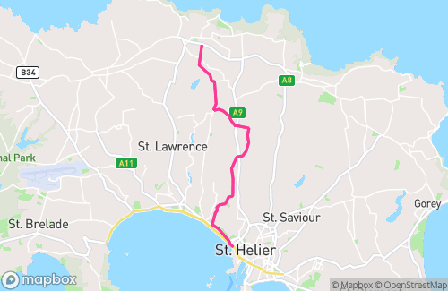
RNR Trail Run: Les Platons - L'Etacquerel (Out & Back)
directions_run13.48 km
elevation628 m
north_east11.97%
south_west-5.05%
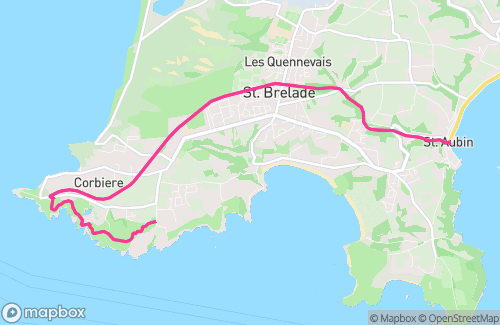
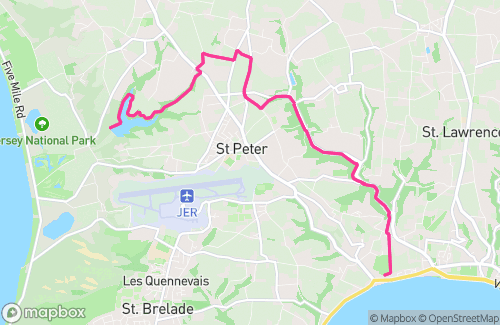
RNRR Trail Run: St Aubins - Corbiere via Railway Walk - La Moye (Out & Back)
directions_run16.17 km
elevation187 m
north_east2.78%
south_west-1.8%
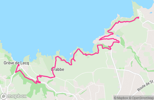
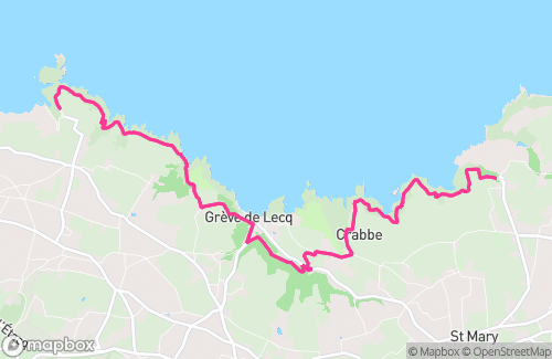
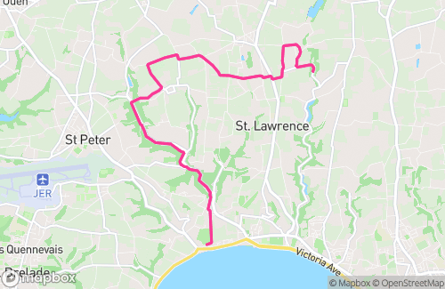
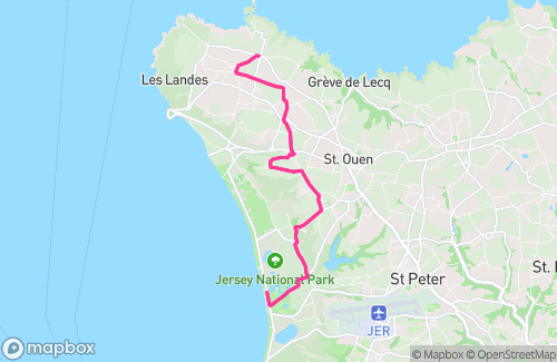
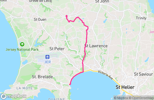
RnRR Trail Run: Greve Woods – Crabbe – Devils Hole – Mourier – Sorel (Out & Back)
directions_run15.98 km
elevation445 m
north_east5.16%
south_west-2.73%
RnRR Trail Run: Goose to Val de la Mar Resevoir (Out & Back)
directions_run16.77 km
elevation223 m
north_east3.3%
south_west-1.43%
RnRR Trail Run: Plemont Top Car Park - Devil's Hole (Out & Back)
directions_run16.04 km
elevation516 m
north_east7.16%
south_west-3.93%
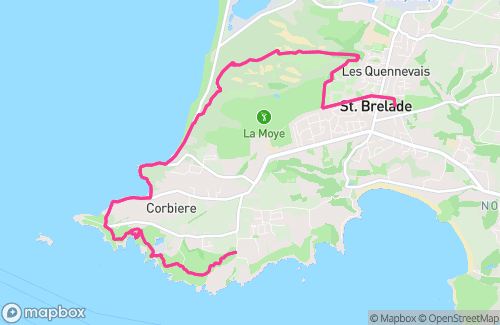
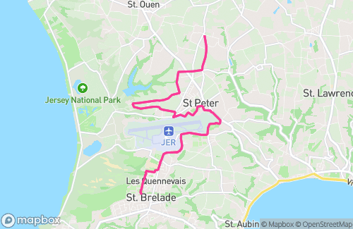
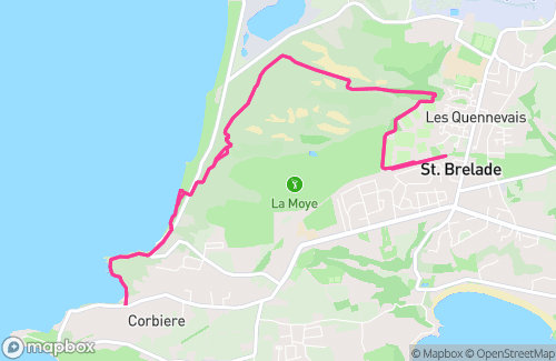
RnRR Trail Run: Elephant Park – Les Quennevais Track – Dunes – Petit Port – Corbiere (Out & Back)
directions_run17.04 km
elevation354 m
north_east6.67%
south_west-3.03%
RnRR Trail Run: Corbiere - Portelet (Out & Back)
directions_run16.79 km
elevation449 m
north_east7.82%
south_west-1.84%
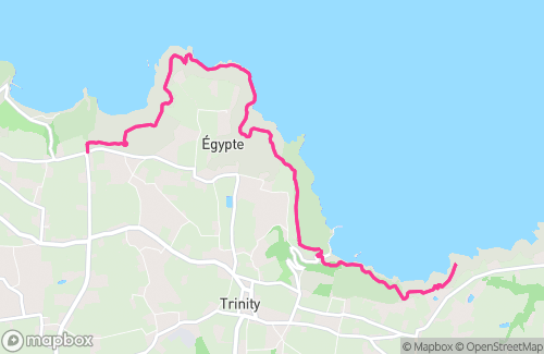
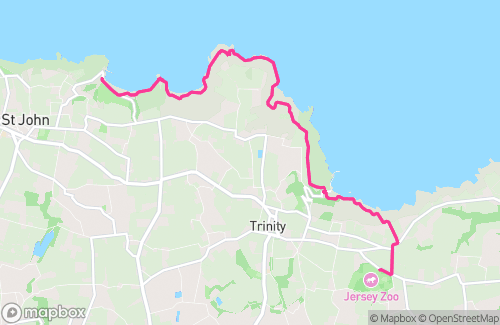
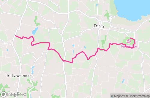
RnRR Trail Run: Durrell-Bon Nuit-Les Platons (Out & Back)
directions_run15.52 km
elevation742 m
north_east12.53%
south_west-4.05%
RnRR Trail Run: St John's recreation centre - Devils hole (Out & Back)
directions_run12.96 km
elevation455 m
north_east4.78%
south_west-1.56%
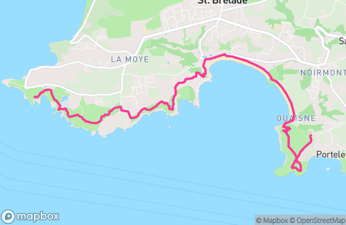
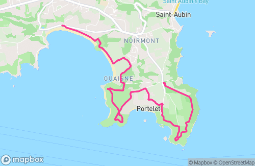
RnRR Trail Run: St Brelades Bay – Ouaisne – Portelet (Out & Back)
directions_run15.17 km
elevation268 m
north_east1.34%
south_west-0.5%
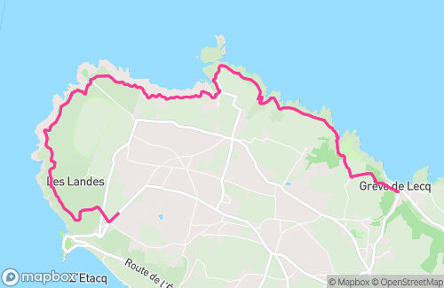
RnRR Trail Run: Maison Des Landes – Greve (Out & Back)
directions_run15.6 km
elevation452 m
north_east4.47%
south_west-2.24%
road
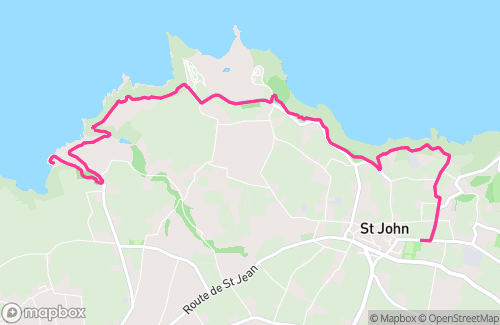
RnRR Road Run: Le Fregate – St John’s Village (Out & Back)
directions_run16.87 km
elevation216 m
north_east3.03%
south_west-1.67%
RnRR Road Run: Goose Green – Hamptonne (Out & Back)
directions_run16.92 km
elevation207 m
north_east3.17%
south_west-1.57%
RnRR Road Run: Fitness First - La Hougue Bie (Out & Back)
directions_run17.62 km
elevation113 m
north_east2.14%
south_west-0.76%
RnRR Road Run: Les Quennevais Playing Fields – Windmill St Mary’s (Out & Back)
directions_run18.51 km
elevation106 m
north_east1.4%
south_west-0.7%
RnRR Road Run: Splash – Cafe Ouen (Out & Back)
directions_run16.25 km
elevation140 m
north_east2.83%
south_west-1.27%
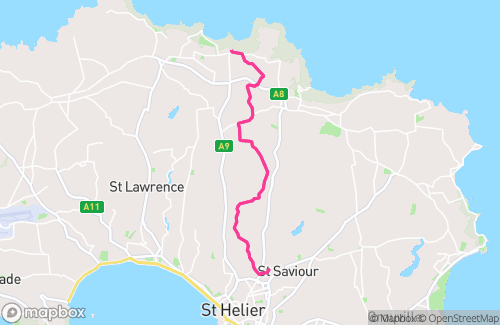
RnRR Road Run: Grand Vaux – Trinity – Les Platons (Out & Back)
directions_run17.4 km
elevation190 m
north_east1.95%
south_west-2.75%
RnRR Road Run: The Windmill – L’Etacq (Out & Back)
directions_run16.28 km
elevation103 m
north_east0.62%
south_west-1.02%
RnRR Road Run: Durrell - Carrefour Selous (Out & Back)
directions_run16.89 km
elevation259 m
north_east2.87%
south_west-1.78%
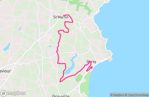
RnRR Road Run: Long Beach – St Martins Church (Out & Back)
directions_run16.4 km
elevation221 m
north_east1.7%
south_west-0.8%
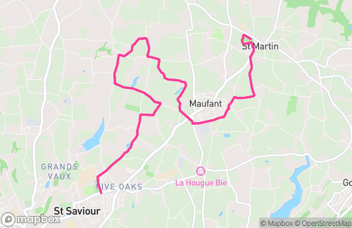
RnRR Road Run: Grainville Playing Fields – Maufant – St Martins Tea Room (Out & Back)
directions_run16.25 km
elevation139 m
north_east1.58%
south_west-0.84%
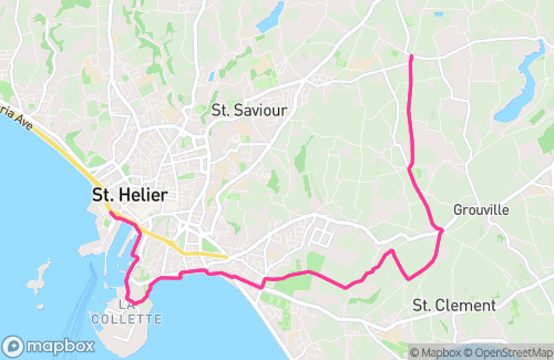
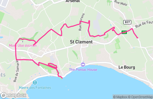
RnRR Road Run: Holme Growne - La Hocq - Pontac (Out and Back)
directions_run12.27 km
elevation190 m
north_east2.72%
south_west-1.4%
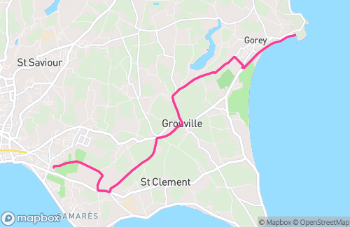
RnRR Road Run: Partners – Grouville Arsenal – Gorey Village – Gorey (Out & Back)
directions_run14.93 km
elevation167 m
north_east2.96%
south_west-1.43%
special
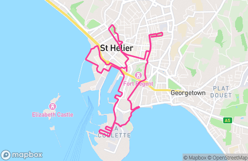
RnRR Trail Run: Les Q – Dunes – Corbiere – Les Q – PARKRUN (Out & Back)
directions_run10.69 km
elevation191 m
north_east5.35%
south_west-0.3%
RNRR Road Run: St Aubins - St Mary's Church (Out & Back)
directions_run17.11 km
elevation147 m
north_east1.21%
south_west-1.5%
NEW YEARS DAY SPECIAL
directions_run9.81 km
elevation43 m
north_east0.63%
south_west-0.63%
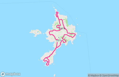
Sark 10 Mile Trail run
directions_run15.33 km
elevation396 m
north_east2.53%
south_west-1.5%
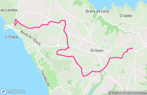
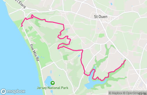
Rock n Road Runners Group Trail Run: Jersey Pearl – Grantez – Val de la Mar (Out & Back)
directions_run14.56 km
elevation393 m
north_east5.73%
south_west-1.15%
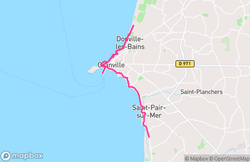
RnRR Tour de Granville
directions_run15.56 km
elevation262 m
north_east8.29%
south_west-4.23%
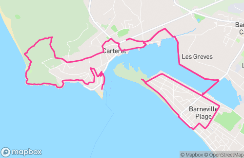
RnRR Carteret - Loop de mini golf
directions_run15.58 km
elevation150 m
north_east2.83%
south_west-0.2%
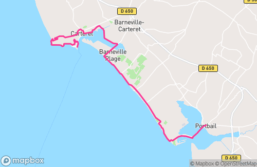
RnRR Carteret - Portbail
directions_run17.66 km
elevation171 m
north_east0.1%
south_west-0.15%